5 TIPS FOR PLANNING A LONG DISTANCE CRUISE
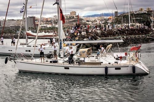
There’s a lot of planning that goes into any long-distance cruise, even if you’re in more well-charted waters than tom partridge and Susie plume on Adina. Tom and Susie recently sent in this list of tips based on the approach they took to planning their passage from Gan, Maldives, to the Chagos Archipelago in the Indian Ocean.

1: SELECT A ROUTE THAT USES FAVORABLE WINDS
Our year started in Thailand with our goal being to reach South Africa by November. The main criteria we use in planning our sailing is to avoid areas of strong wind activity and to sail with winds and seas that will help us to reach our destination in relative comfort. We consult pilot atlases, cruising guides, and blogs from those who have done it before. A pilot atlas is particularly helpful as it provides historical data about the winds and currents that can be expected in various parts of the world at different times. Based on our research we opted to sail in the northern hemisphere for the first part of the year before heading south of the equator when the cyclone seasons switch between hemispheres.
2: MAKE A HIGH LEVEL PLAN
For the first part of the year winds favour exploring countries in the northern hemisphere, including Sri Lanka and the Maldives. By May/June the transition season between the cyclone seasons would set in and we would need to be heading south. Transition seasons are tricky and winds can be fickle. Fortunately, below the Maldives at five degrees south is the Chagos Archipelago, or British Indian Ocean Territory (BIOT) as it is formally known. We aimed to cross from the Maldives to BIOT in mid-May and wait there until the southern hemisphere south-easterlies kicked in before sailing west to experience the many islands of the Seychelles.

3: NEXT, MAKE A PASSAGE PLAN
For each passage we take into account factors such as wind, sea state and current. The route from the Maldives to BIOT requires us to cross the strong equatorial counter-current flowing from west to east. We risk missing our destination if we ignore it. Looking at the wind forecasts we think we should sail west away from our rhumb line at the start to make sure we have some westing in reserve if the wind turns unfavorable or even, as is common, stops blowing. Some shallows hint at good fishing and we decide we’ll sail over them with the hope of a bite or two! A hand-written passage plan with details of our route as a contingency helps should our electronics fail us.

4: LAST BUT NOT LEAST, MAKE A PILOTAGE PLAN
Our destination in BIOT, the Salomon Atoll, is scattered with large coral heads commonly known as “bommies” which sit just below the surface and can literally ruin your day and much more besides! Paper and electronic nautical charts are both vital and in addition we use satellite images to check for any inaccuracies. We prepare a leg-by-leg pilotage plan that we will use to refresh ourselves just before our arrival. Knowing we will need a good look-out with the sun behind us or just overhead for visibility to spot the coral heads is another factor that we add into our plans: we need to arrive between 9am and 12 noon.
5: GET OUT THERE
No matter how many times you do this, no matter how well prepared you are, the nerves still jangle. What will it be like out there? Will we get strong squalls, storms or lightning as is common near the equator? Will the forecast be right? How strong will that current be? Will the sea be rough? We’ve prepared as well as we can and we know all these questions can be answered in one way only – by getting Adina out into the open ocean again.
